Geomatics Science and Engineering
Geomatics is a field that collects geospatial data about the world around us and uses tools like land surveying, remote sensing, GIS systems, geography and computer science to help digitize the world.
This knowledge and data can then be used to decide where buildings, roads and houses are built, power the technology of self-driving vehicles, assist in emergency and disaster management and much more.
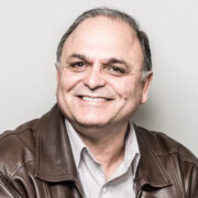
Costas Armenakis
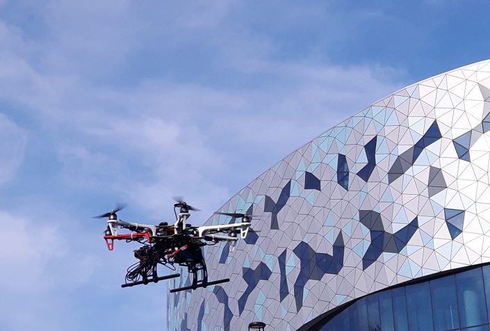
Dr. Armenakis’ research interests are in the areas of rapid and on-time mapping and monitoring methods and technology using imaging and ranging data. Current research areas include: a) the development and use of low-cost unmanned aerial mapping systems (UMAS) and mobile mapping systems for rapid mapping, monitoring and tracking to explore their potential and reliability in operational environments; and b) the development of methods and technology for spatial feature extraction, terrain modelling and spatio-temporal change detection and extraction from imaging and ranging data using photogrammetric, remote sensing and GIS methods.
Sunil Bisnath
Dr. Bisnath’s research interests centre about the use of Global Navigation Satellite Systems (GNSSs), most notably GPS, for a multitude of precise positioning and navigation applications. Specific application areas include crustal deformation monitoring, precise orbit determination, and precise positioning of offshore platforms. This research requires development of positioning algorithms, which include filters, functional models, stochastic models, and prediction models to mitigate physical affects. Recent algorithm research has focused on improving the robustness of precise point positioning, and extending the range of single-baseline, real-time kinematic (RTK) GPS.

Baoxin Hu
Dr. Hu’s research interests include canopy reflectance modelling, deriving biophysical parameters of forest canopies from remote sensing data, hyperspectral remote sensing, image processing, and photogrammetry.
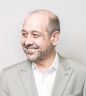
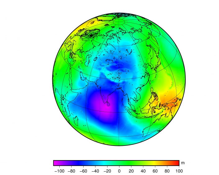
Spiros Pagiatakis
Dr. Spiros Pagiatakis is interested in the dynamics of the Earth, both in global and regional/local scales, as observed by geodetic techniques. On-going research includes the determination of the glacial isostatic adjustment signature from more than 50 years of terrestrial gravity observations in Canada and GRACE gravity mission level-2 data. Research interests also expand in the area of physical geodesy, and in particular in the determination of the geoid (local and global scales) and of the sea surface topography. Other research activities include the study of the response of the Earth to ocean tide loading, spectral methods and their application to the analyses of superconducting gravimeter (GWR), Very Long Baseline Interferometry (VLBI) and GPS time series.

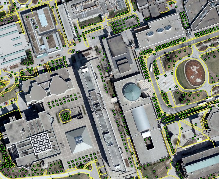
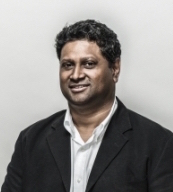
Gunho Sohn
Dr. Sohn’s research focused on developing fundamental theories and working systems to generate photo-realistic, highly accurate and large-scale 3D urban space models from remotely sensed data. His laboratory is leading the field in developing the implicit modeling approach for 3D building rooftop reconstruction using aerial laser point clouds and imagery. His research group is of the few groups in the world that has made significant contributions in the area of suspension type power line mapping and modeling from aerial laser point clouds and they are one of the first groups to successfully develop a dynamic 3D web mapping system infusing ubiquitous and real-time information into the otherwise static 3D virtual space engine (e.g. Google Earth).

Jian-Guo Wang
Dr.-Ing. Wang’s research interests centre about the applications of Integrated Navigation and High Accuracy & Precision Engineering Surveying. Good example for Integrated Navigation is multi-sensor systems, the core of modern direct-georeferencing systems that integrate the GNSSs, Inertial sensors, and any other positioning & orientation sensors available. The research in this area innovates and develops advance algorithms including error modeling, Kalman filtering, robust filtering, system simulation, hardware integration, and real-time & post-processing SW development. High Accuracy & Precision Engineering Surveying engages special engineering surveying applications such as deformation monitoring and industrial surveying.
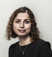
Mojgan (Amaneh) Jadidi
Dr. Mojgan Jadidi embraces the power of location turn to knowledge discovery for better and informed decision making in the context of smart buildings, infrastructures and cities. Dr Jadidi’s research interest include Building Information Model (BIM) and 3D GIS Integration, Spatial Graph and Online Analytical Processing (OLAP), Geospatial Knowledge discovery and Data Mining in 2D and 3D spaces for applications of Smart Environmental/Building/Cities and Intelligent Transportation. Also, she has passion for engineering education using virtual reality and gamification technologies and learning analytics. Her research has been funded by multiple grants from NSERC, Mitacs, COMREN, Academic Innovation Fund (AIF), and internal York University funds.
She is currently associate Director of ESRI Center of Excellence at York University.
She is currently associate Director of ESRI Center of Excellence at York University.