How Geomatics Plays a Big Role in the Forestry Industry
GeoTalks Webinar Series: November 25, 2020 – Dr. Kevin Lim
GeoTalks is a biweekly virtual seminar series organized by Geomatics Engineering at York University and the Canadian Institute of Geomatics – Toronto Branch. The series features industry leaders and entrepreneurs in geomatics as it explores geospatial science and engineering.
On November 25, 2020, we welcomed Dr. Kevin Lim to speak at our GeoTalks webinar and discuss the topic of Geomatics and Forestry, as well as his entrepreneurial journey.
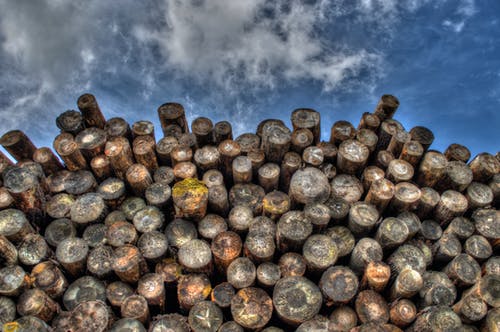
Forestry is often a major driver for local economies in rural areas. The products produced by the industry are universal and crucial to our daily lives, including lumber used for home construction and wood products used to create toilet paper.
In his talk, Dr. Lim explored the role geomatics plays in the world of manufacturing and discussed his work with lidar (Light Detection and Ranging). His company, Lim Geomatics, uses lidar to create maps of small sections of forests that contain massive data sets. Other companies can then use this data and manipulate it in a web app to gain insight about an area and aid in planning.
Dr. Lim also touched on the challenges involved in persuading companies to adopt new technologies in a field in which some workers still rely on notepads, clamshell cellphones and manual measurements of trees.
Research and development hot spots in the forestry and geomatics sector were also discussed. Species identification, mapping and individual tree extraction were highlighted as in-demand areas for students looking to commercialize their research, but no matter the pathway, Dr. Lim’s advice was to start small, narrow your focus and test the waters.
For students with a passion for entrepreneurship, Dr. Lim offered tips on how to embrace discomfort to grow, stay laser focused, be your own salesperson and more.
About Dr. Lim
Dr. Kevin Lim received his PhD from Queen’s University in 2006. He founded Lim Geomatics in 2006. Since then, the company has emerged as an industry leader in the forestry market. Its goal is to build geospatial software and data for forestry companies to help them be more efficient with their office and field operations.
Lim Geomatics leverages GIS, remote sensing, IoT and AI and has customers in Canada, the United States and South Africa.
Watch Dr. Lim’s GeoTalks Webinar to learn more.